Natural Resources Canada
www.nrcan.gc.ca
Home Pictures and Maps
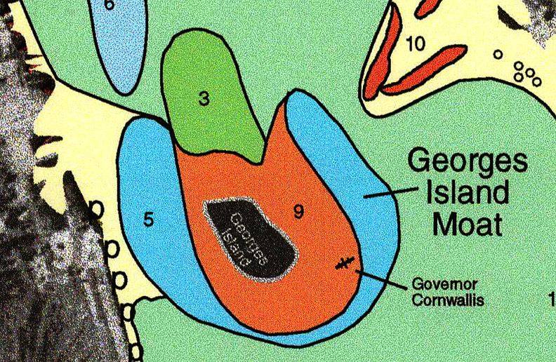
An interpretation of the multibeam bathymetry from around Georges Island that shows the location of the moat (5) and a sediment drift (3) to the north of the island. Area 9 represents the flank of Georges Island.